Winter storm warning issued for Rowan County, ice accumulation expected
Published 10:19 am Wednesday, February 17, 2021
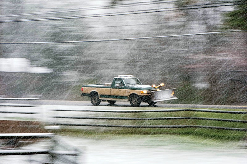
- SALISBURY POST FILE PHOTO -A pick-up trick with a snowplow moves up Salisbury Ave. in Granite Quarry in February 2020.
SALISBURY — The National Weather Services has placed Rowan County and other parts of the region under a winter storm warning until 7 p.m. Thursday.
Significant ice accumulations are expected, with total accumulations as high as one-quarter inch in parts of Rowan County, according to forecasts issued Wednesday morning. Higher accumulations in Rowan County are expected north of Salisbury and Interstate 85. Across the Piedmont and North Carolina Foothills, accumulations of one-tenth to four-tenths of an inch are expected.
The ice may cause power outages and tree damage due to the ice. In some parts of the region, “travel could become nearly impossible,” the National Weather Service said.
Steve Monday and Rowan County Weather say that it won’t take much ice to cause trees to fall because the ground is saturated from several days of rain. Monday’s forecast is slightly higher than the National Weather Service, saying up to three-tenths of an inch are possible in the county.
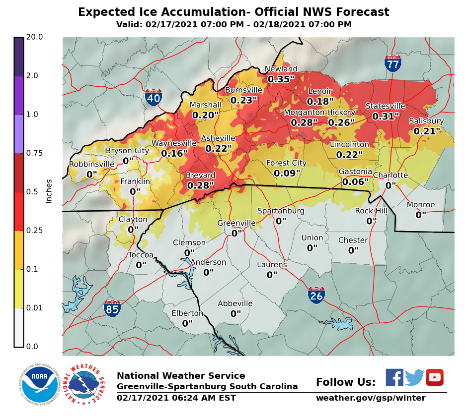
This graphic from the National Weather Service shows a Wednesday morning projection for ice accumulations. Click on the image for a larger view.
The National Weather Service says a mix of rain and freezing rain is possible between 3 and 4 p.m., with precipitation switching to freezing rain after 4 a.m. Freezing rain is projected throughout the day Thursday, with only rain projected after 1 p.m. Temperatures tonight and Thursday night are expected to drop to 32 degrees. It will be colder Friday and Saturday night, with temperatures dipping into the low 20s.
The National Weather Service encourages people to make preparations in the event that they’re impacted by severe weather.
“Travel is strongly discouraged. Commerce will likely be severely impacted,” the National Weather Service said. “If you must travel, keep a flashlight, food, and water in your vehicle in case of an emergency.”