As track changes, Rowan prepares for Hurricane Irma
Published 6:50 am Friday, September 8, 2017
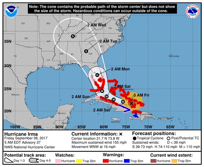
- The track of Hurricane Irma as of 5 a.m. Friday.
Rowan Emergency Services
Over the last 12 hours, the hurricane track models have made a significant change in the project path of Hurricane Irma (see attached graphic). Models now are indicating that once the storm makes it right turn and makes landfall onto Florida, models indicate the storm to remain over land and track north-northwest across Florida, Georgia and into central Tennessee.
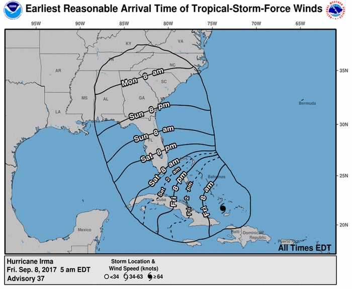
With a more westward track, a reduction in the wind field may occur locally, however, due to the overall size of the storm, and specifically to Rowan County, the higher possibility for tropical storm force winds (greater than 39 mph), would begin to be experienced here early Monday morning (see attached graphic on Wind Arrival Times).
As with the wind, the likelihood of some reduction in total rainfall amounts may occur (see attached rainfall graphic), however, areas of the region could easily still experience 4-6 inches of total rainfall. Even with these potential reductions, the real possibility remains for utility and other weather related issues to occur. While model guidance is becoming clearer as we move into the weekend, additional change could occur.
Thursday, key local government and public safety leadership reviewed developing local storm preparations. Those preparations are ongoing. That key leadership is scheduled to meet again today at 3:30 p.m.
The Rowan County Emergency Operations Center remains at Level 4 (monitoring conditions), and is scheduled to increase its operational level to Level 3, (established but unmanned) at 4:30 p.m. today, in order to provide operational readiness if needed over the weekend or into next week.
The next update will be issued in 24 hours unless significant changes warrant otherwise.