How to use Rowan County’s Damage Assessment Map
Published 4:45 pm Friday, September 14, 2018
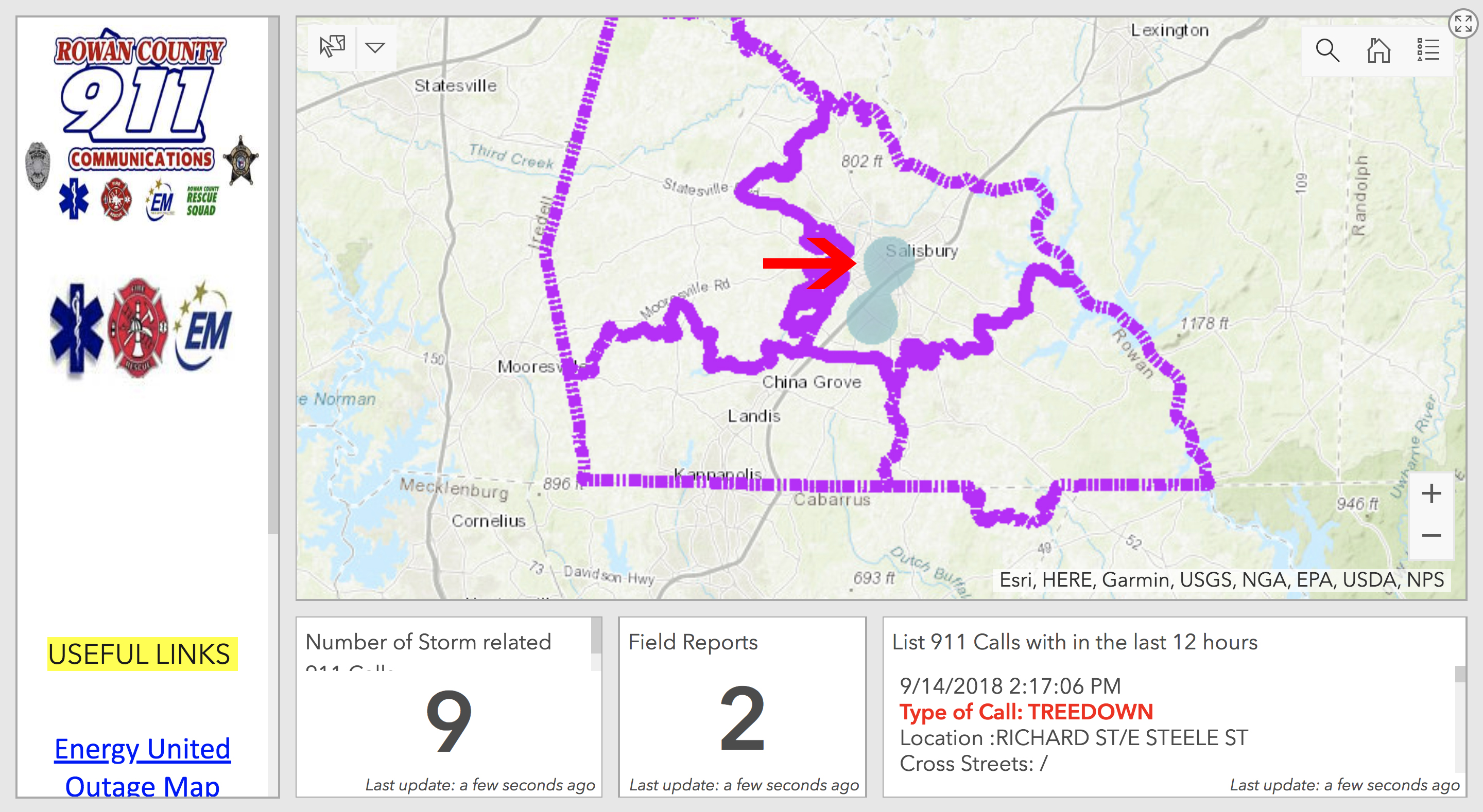
Keep up to date with the effects of Hurricane Florence in and around Rowan County with the county’s recently launched Damage Assessment Map.
The map provides real-time information about incidents and reports received relative to the storm, including downed trees, downed power lines and failed traffic lights.
The map also provides residents with flood plain mapping, allowing homeowners and business owners in the area to identify if they are at a high risk of flooding as rainfall continues through the weekend.
Use the map by following the steps below:
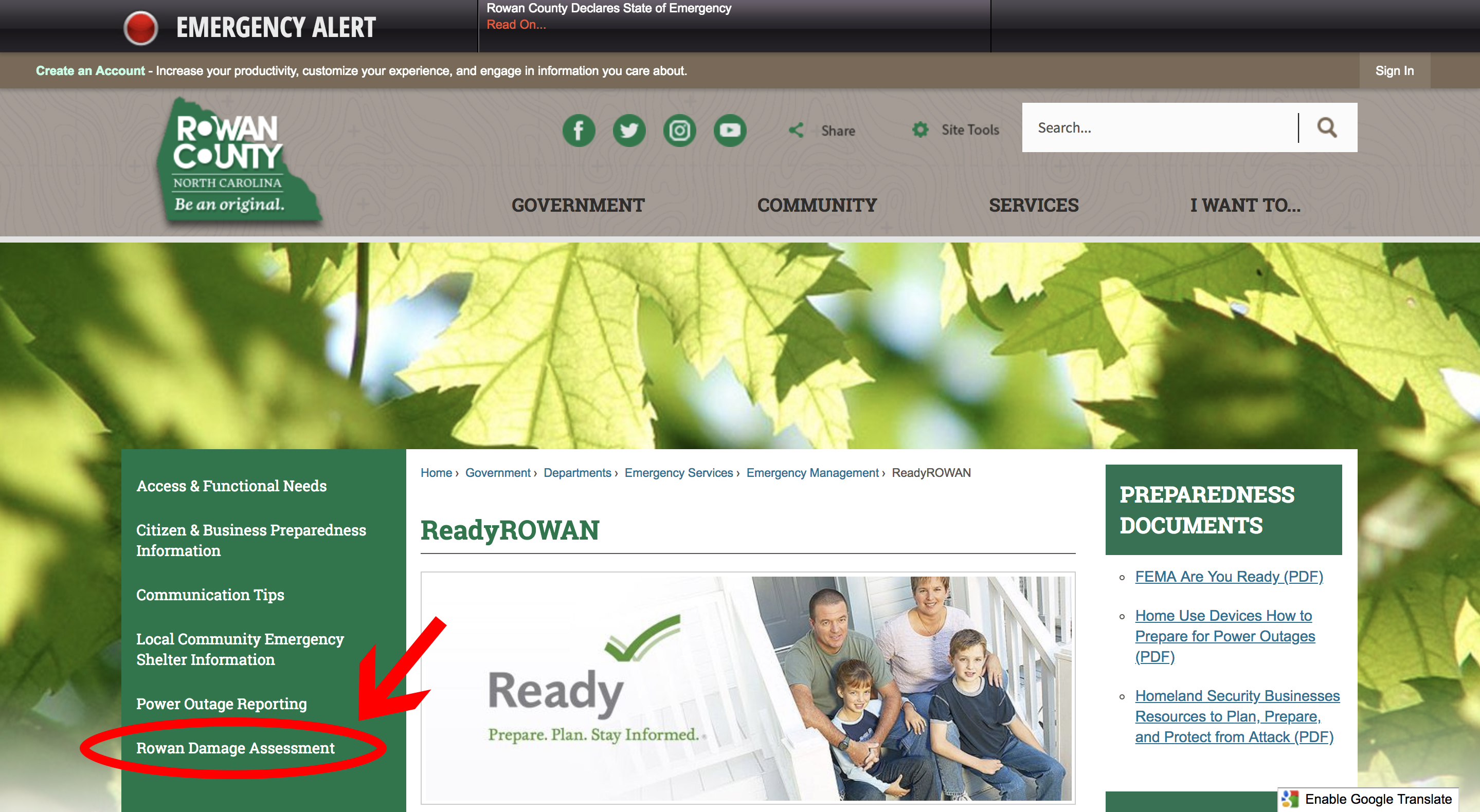
1. Open a web browser (Chrome, Firefox, Safari, Internet Explorer, etc.) and navigate to readyrowan.com.
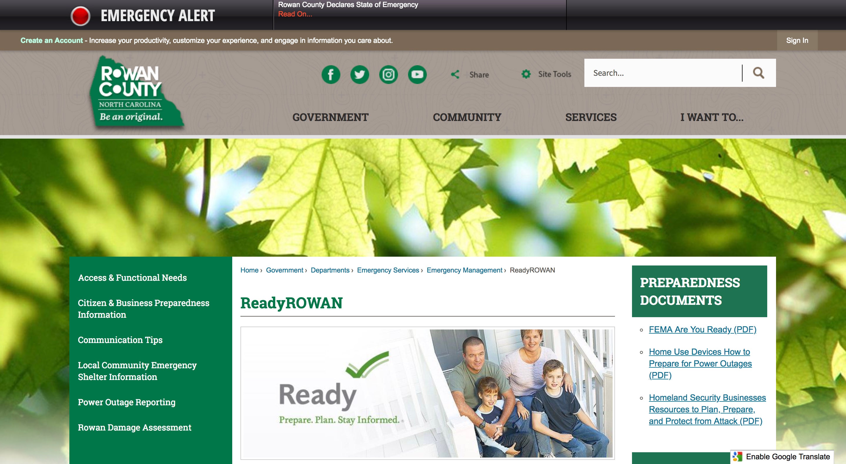
2. Locate and click on the text “Rowan Damage Assessment” in the page’s left hand, green column.
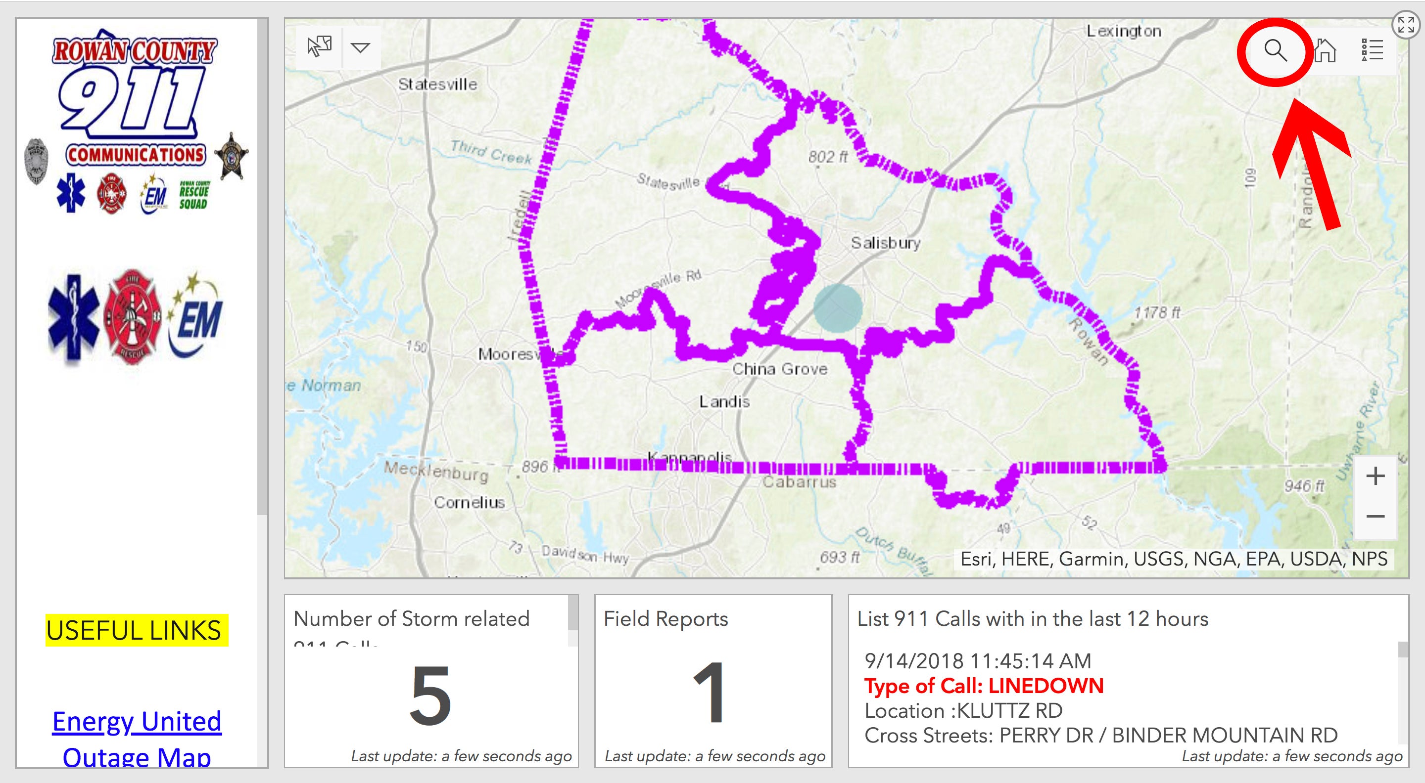
3. Locate and click the search button in the top right corner of the displayed map.
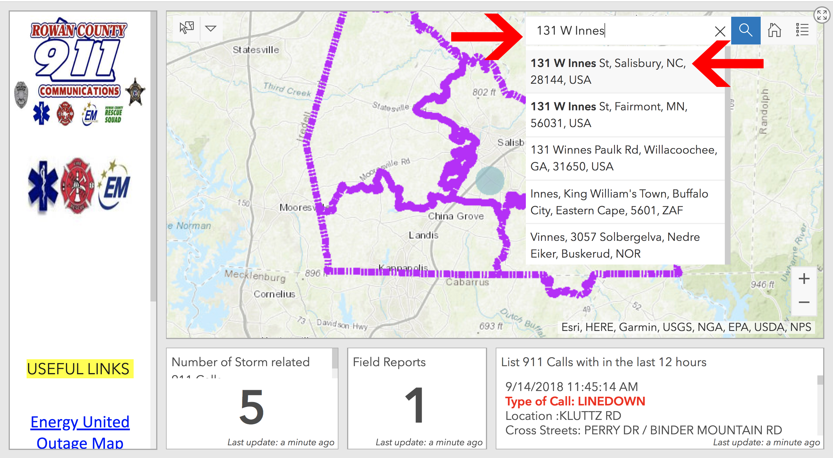
4. Enter your address into the search bar. Click your home or business address from the drop-down menu.
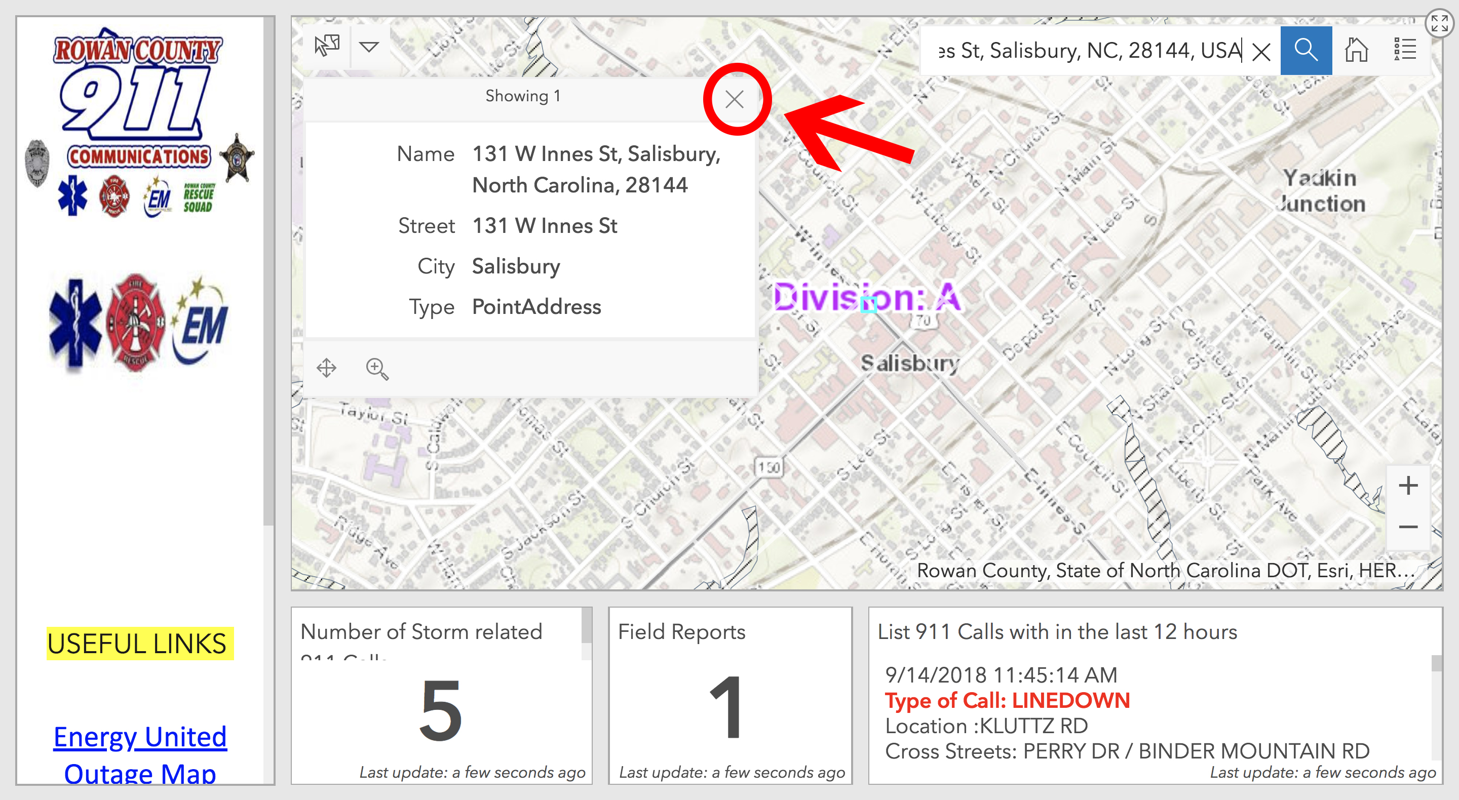
5. Clear your viewing area by hitting the “x” button in the upper right corner of the box containing your search. The map is now centered on your search query.
6. Use the “+” and “-“ icons at the bottom right corner of the map to zoom in and out for your search. You may also click, hold and drag or use arrow keys to explore.
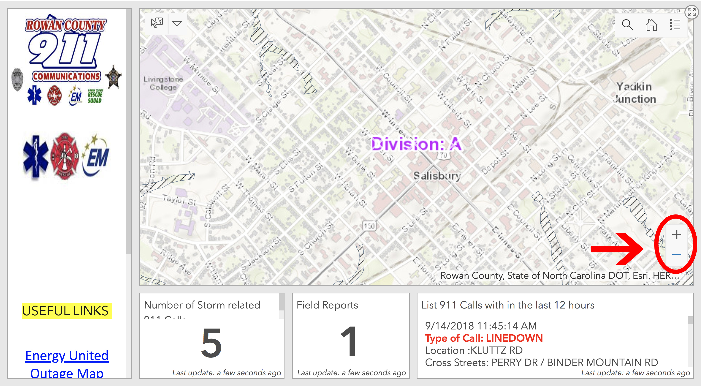
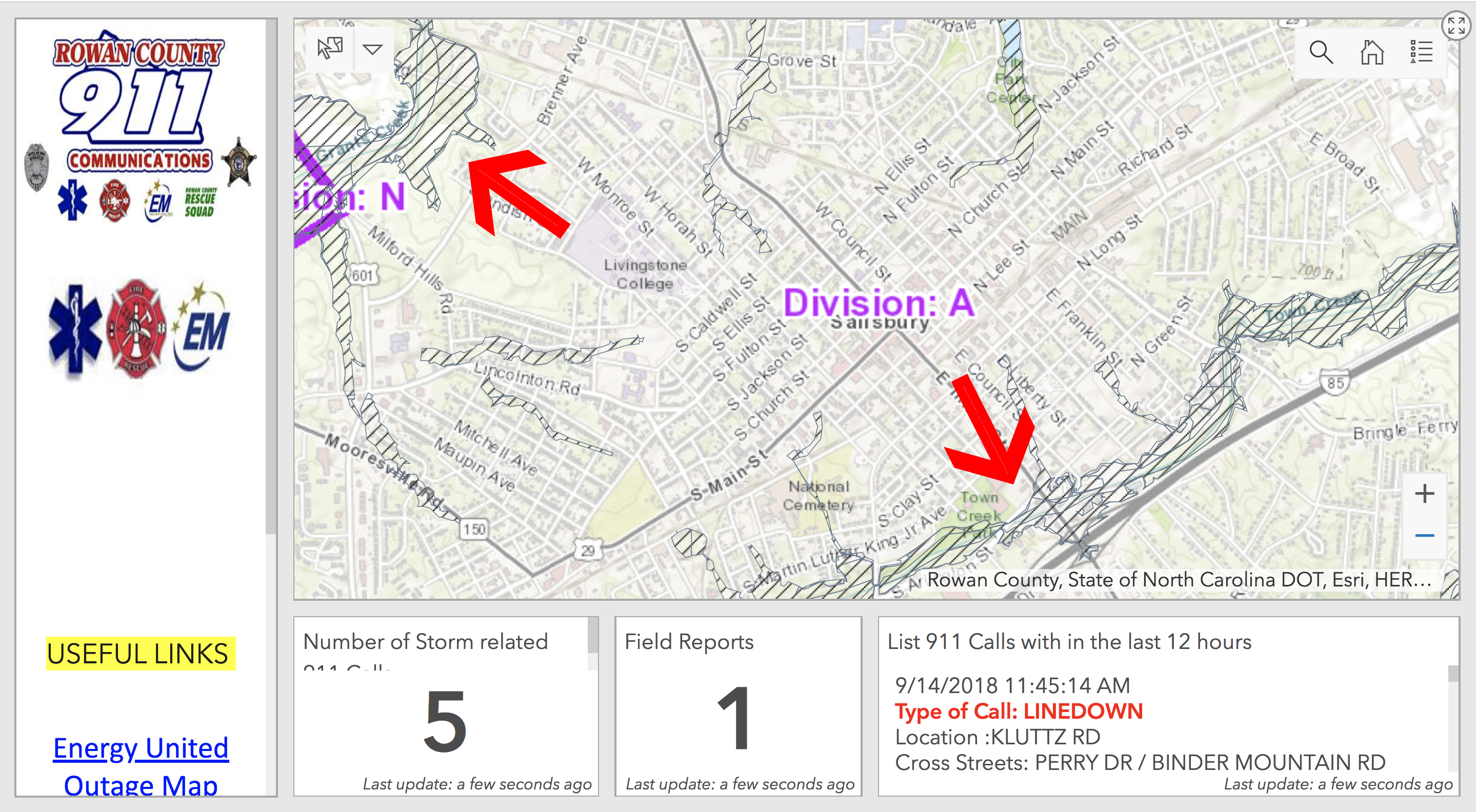
7. Note flood plain areas marked by black borders filled with diagonal lines. These denote flood plains, areas prone to flooding.
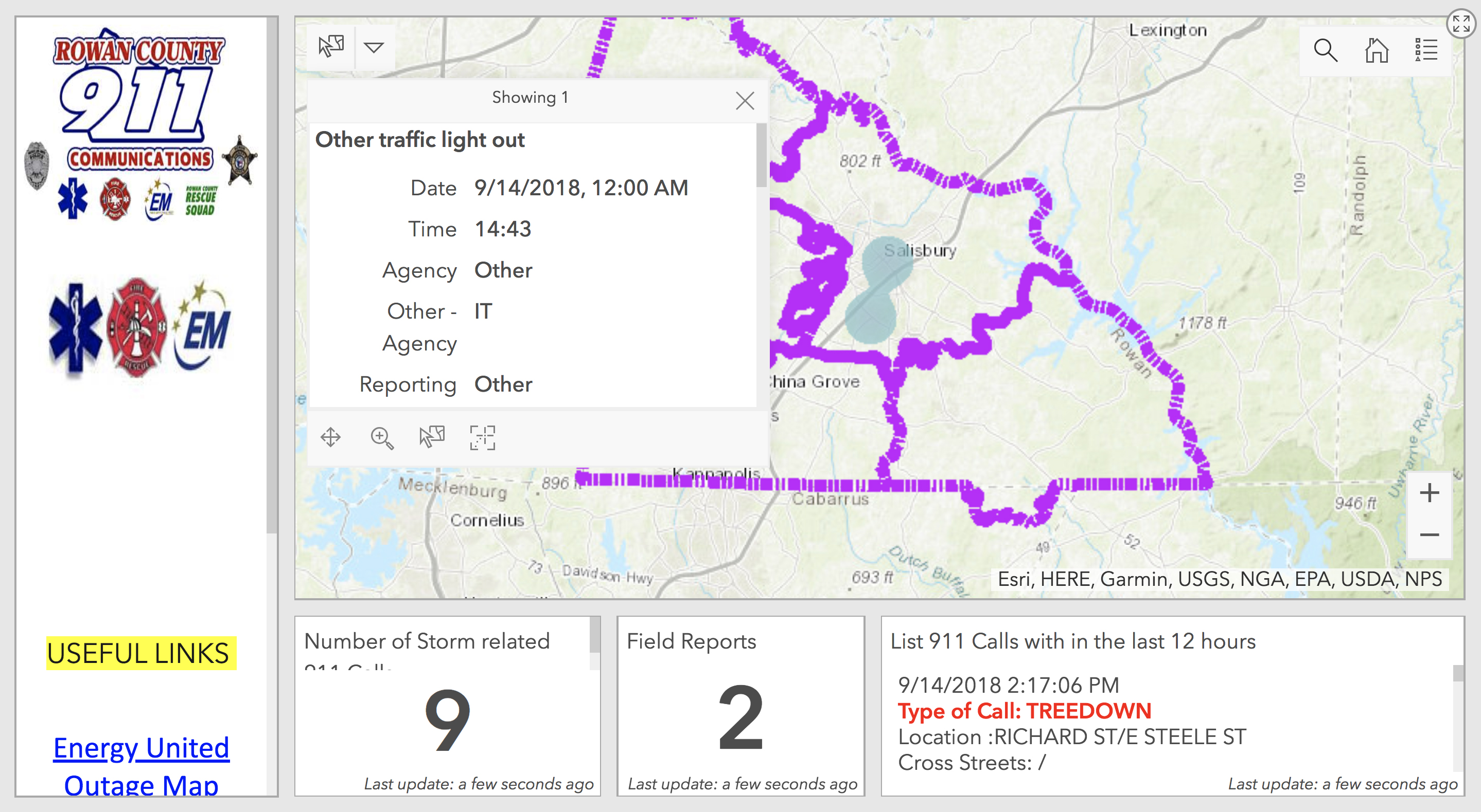
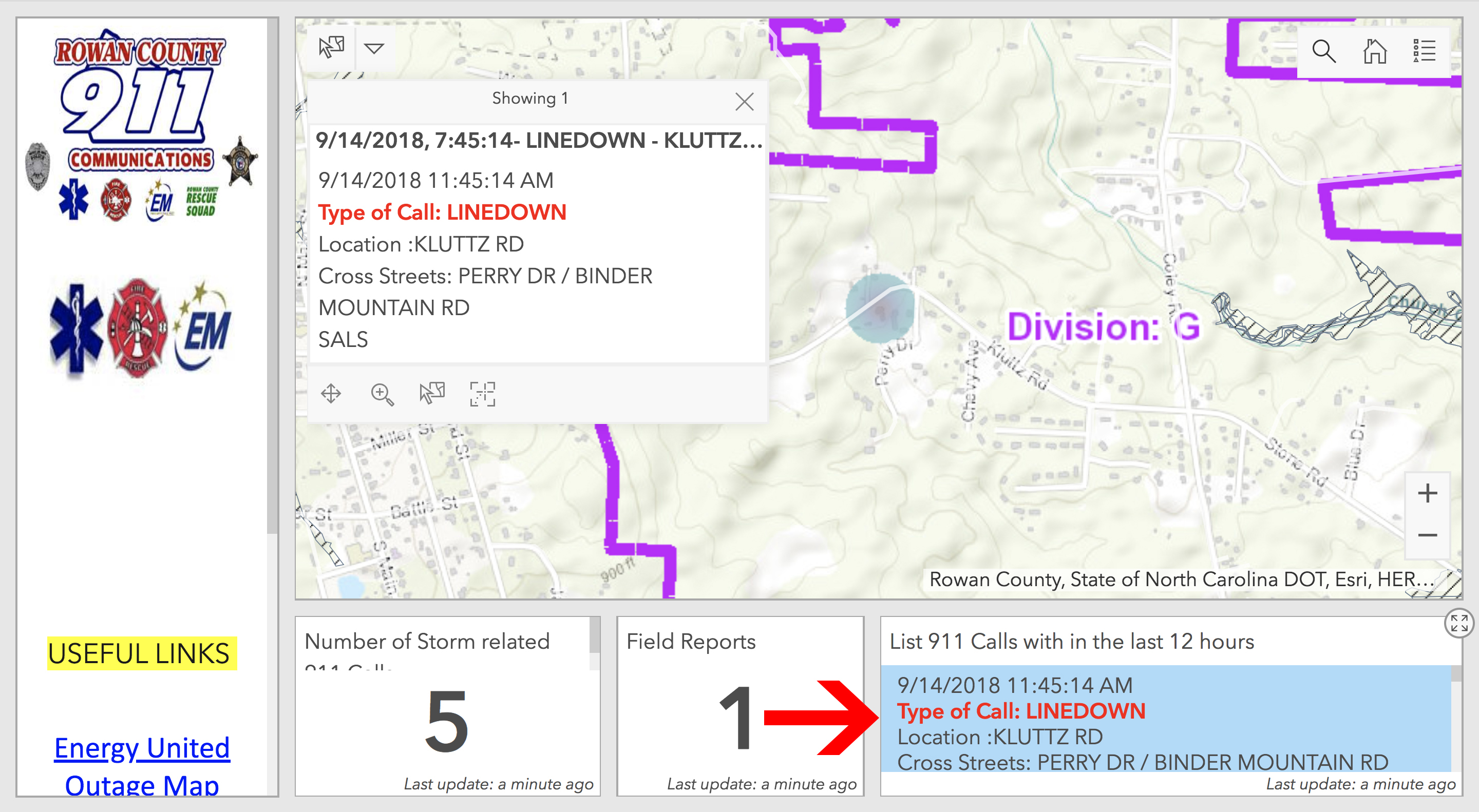
8. Explore recent reported incidents by clicking the listings in the bottom right box labeled “List 911 calls within the last 12 hours.”
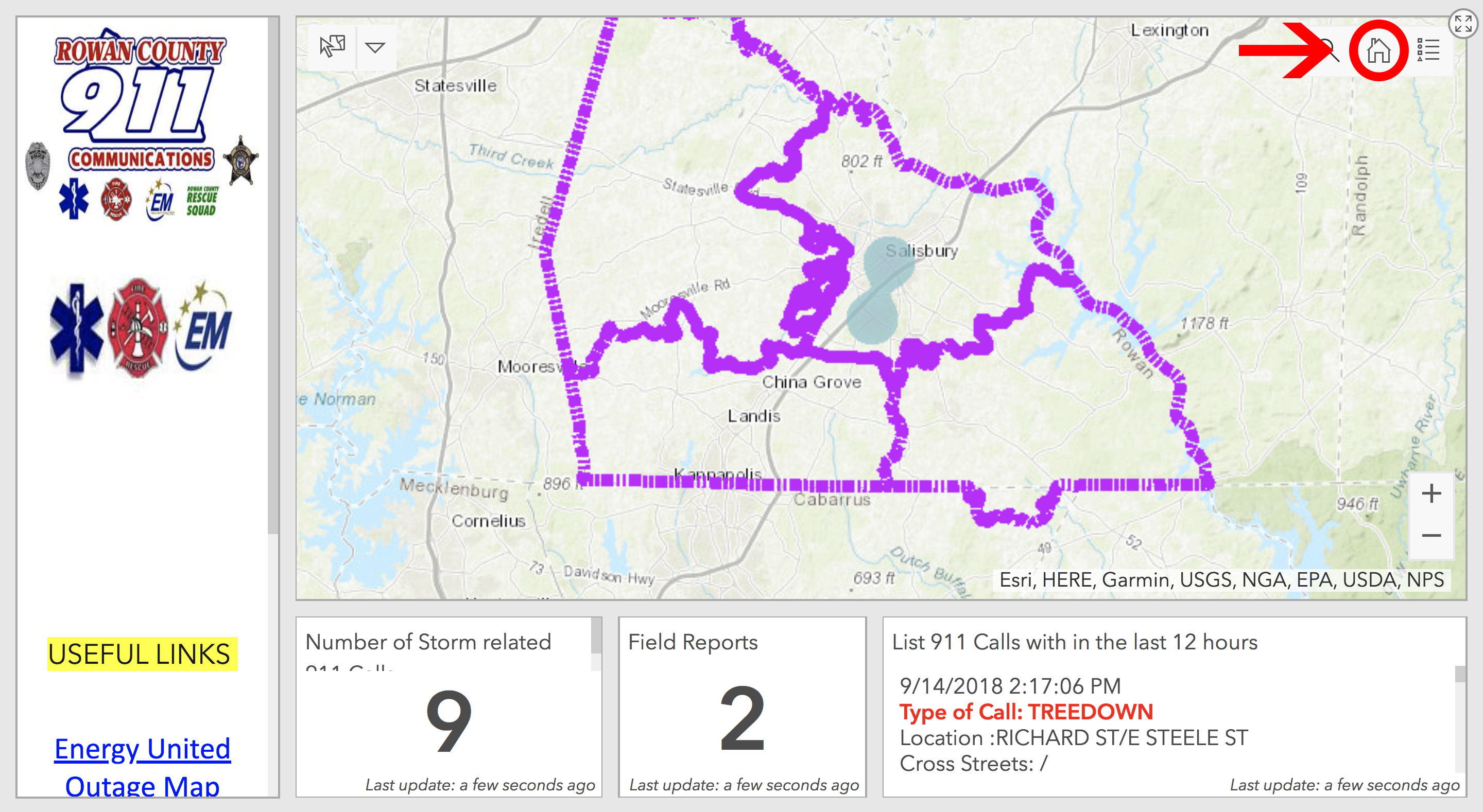
9. Center the map on the county by clicking the home icon in the top right corner of the map.
10. Click the blue highlighted areas to explore field reports in the area.