Severe thunderstorms may develop later today
Published 4:43 pm Friday, July 8, 2016
The atmosphere has become hot and humid, and quite volatile. As a result another round, or multiple rounds, of thunderstorms can be expected primarily from later this afternoon into Friday night across the region.
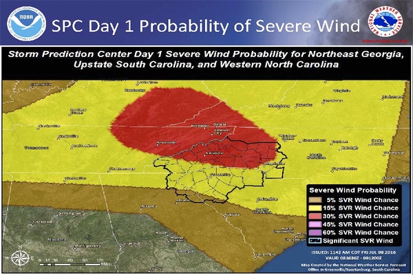
Note: Storm development in this type of environment will be rapid. Much of the area is now under a Slight Risk, or an Enhanced Risk of severe thunderstorms The primary hazards again will be damaging winds, large hail, brief torrential rain and frequent lightning strikes.
The Weather Service is monitoring the possibility of a swath of extensive wind damage, and isolated very large hail, especially across parts of western North Carolina. (see attached graphic)
Additionally, heat indices will near or top the 100 degree mark at many locations outside the mountains both this afternoon and Saturday. The hot conditions will persist into Saturday. (see attached graphic)
For those in poor health, the young and elderly, try to stay in cool air conditioned locations.
The possibility of severe thunderstorms, which might bring down more trees and power lines, could worsen the heat situation with a potential loss of power.


