Thanks to Butners, century-old map comes out of hiding
Published 12:00 am Saturday, December 22, 2012
When you examine this early 1900s map of Salisbury, you can’t help but see what’s not there.
Take the Square — the intersection of Innes and Main streets — and a block’s distance in all four directions.
First of all, the C.M. Miller map labels it as “Inniss” Street.
But the map also documents a turn-of-the-century time before there was a Plaza building, an impressive post office and federal courthouse, Salisbury Post, Washington Building, Wachovia Bank, Belk or City Hall.
Instead, there are a lot more homes, an opera house in the 100 block of North Main Street, a livery stable in the 100 block of West Innes Street, the old Victor Wallace & Sons Wholesale operation on East Fisher Street and the public fountain smack dab in the middle of the Square.
A West Council Street lawyer’s row of offices exists near the old Courthouse — today’s Rowan Museum. Some of the names of the attorneys still sound familiar today — Kluttz, Price, Rendleman, Clement, Wright and Craige.
A corner of this section of the map records Salisbury’s town officials of the day: Mayor A.H. “Baldy” Boyden and Aldermen W.C. Coughenour, J.G. Heilig, T.H. Vanderford, M.A. Shank, W.L. Rankin, G.W. Wright, J.F. Weber and C.H. Swink.
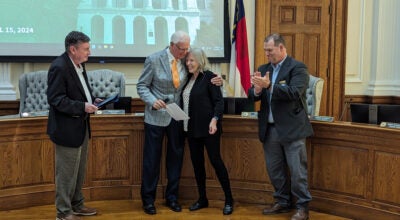
In the summer, Realtor Mac Butner and his family donated this large, 5- by 7-foot map to Rowan Public Library.
“It’s a piece of history that fills a void, and we’re happy to do it,” Butner says. “No big deal.”
Still, it was a great present to the county archives. Gretchen Beilfuss Witt, librarian for the Edith M. Clark History Room at the library, puts the map’s age at circa 1902.
“We did have it photographed,” she said in a letter to Butner, “and in examining the details we found Presbyterian Church Tabernacle across the street from the Boyden property (what is now the library lot).”
The tabernacle is still indicated at that location on a 1902 Sanborn map of Salisbury in the archives. And historians know the tabernacle was destroyed in 1905.
The listing of Boyden and his aldermen also is a good indicator of the map’s age, because that particular group was in office from 1901-1903.
“The map is a terrific resource and fills a gap in our map collection,” Witt said, adding it will be helpful to genealogical and historical researchers, “as well as being an historic treasure itself.”
Calvin M. Miller apparently produced many maps of N.C. counties and towns during this era.
A quick online search shows the Guilford County Genealogical Society offers for purchase copies of a Miller map of rural Guilford County from 1908. The map includes, for example, townships, owner-occupied homes, tenant houses, schools and churches.
The University of North Carolina at Chapel Hill has it its collection a 1904-1910 Miller map of Stanly County. It is printed in color and mounted on linen.
The Stanly County map designated mines, mills, townships, creeks and streams, businesses, houses, landowners, churches, post offices, public buildings, roads and schools.
The same can be said for much of Miller’s Salisbury map, which even shows water pipes and hydrants.
“Salisbury is one of the most important railroad centers in North Carolina,” an information box on the map says. “The climate is excellent. There are splendid systems of Gas Works, Electric Lights and Water Works and Sewerage.
“Salisbury Granite is unlimited in amount and equal to the best in the world. Cotton Factories and Industrial Enterprises are numerous and increasing. Headquarters for Gold Hill Mines and for the Whitney Reduction Company, which is developing 46,000 horsepower at the Narrows of the Yadkin. The Salisbury Graded Schools are equal to the best.
Miller believed in capital letters.
Butner says his late mother, who was in the antique business, purchased the map many years ago, but no one knows where or when.
She had a antiques shop at 1428 N. Main St. and also purchased a Victorian house next to the Fulton Masonic Lodge to house some of her overflow items.
In advance of the Butners’ selling that house to the Masonic lodge, family members were cleaning out the place (later lost to the wrecking ball), and they noticed the map. As things were being divided up among family members — Mac has a sister with an antiques shop in the Lake Norman area — Butner’s father told him to take the map.
Again, Butner and his wife placed the map in storage until they rediscovered it last year. They decided something should be done to save the map before it deteriorated completely.
“It was in kind of rough condition,” Butner says.
At a 2011 Christmas party, Butner approached Mayor Paul Woodson to ask whether the Butners could donate the map to the city, with hopes that the government could pay for its restoration.
Woodson eventually learned a restoration would cost $5,000 and gave the map back to Butner saying the city probably shouldn’t spend that kind of money on preserving the artifact.
Butner later asked Chip Short, his personal attorney who has strong ties to the library, whether the library would be interested. Short did some investigation and reported back to Butner he really had an important find.
“So I donated it to the library, via Chip,” Butner says,
Butner knows how tight money is in local government to even consider restoring the map. He’s happy enough that it’s in the library’s possession and the steps were taken to preserve its information through a series of photographs.
So now you have the story of a man and a map.
Think of it every time you drive on “Inniss” Street.
Contact Mark Wineka at 704-797-4263,or mwineka@salisburypost.com.


